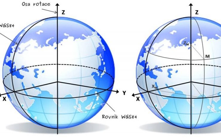
By the decision of the Board of the State Service of Geology and Mineral Resources of Ukraine, the transition from the Soviet geodetic coordinate system Pulkovo-42 (SK-42) to the World Geodetic System WGS-84 (World Geodetic System) was approved from January 1, 2021. At the same time, a transitional period was established, during which subsoil users are recommended, taking into account the specifics of minerals, to indicate in the documents the geographical coordinates in two systems, Pulkovo and WGS, with an accuracy of hundredths of a second for the latter.
A full transition to the WGS-84 geographic coordinate system with the introduction of appropriate changes in the coordinates of the corner points of the subsoil plot in the special permit form for subsoil users who received such a permit before January 1, 2021, must be carried out within two years for minerals of national importance and in for three years for local minerals.
It is expected that in the near future the State Scientific and Production Enterprise "Geoinform of Ukraine" will additionally ensure that the coordinates of the sites recalculated from the Pulkovo-42 system to the WGS-84 system are reflected in the database of special permits. Geoinform should also reflect the mechanism for translating one coordinate system into another on its official website, - the Board decided.