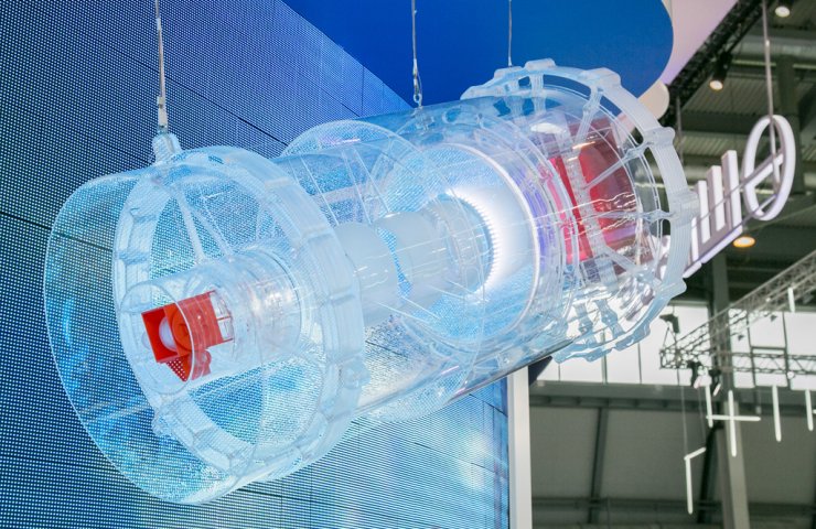
Shvabe Holding of Rostec State Corporation presented at the 12th International Exhibition Navigation Systems, Technologies and Services a model of the Aurora system for creating digital maps from space during emergencies and environmental disasters. The development was created by the enterprise of the holding - the Krasnogorsk plant named after S.A. Zvereva. The Navitech exhibition is open in Moscow until November 6.
Optoelectronic equipment "Aurora" is a wide-coverage multispectral device for monitoring the state of the Earth's surface from aboard small spacecraft. It is designed to deliver high fidelity images to your monitor screen.
"Aurora" allows you to solve a wide range of tasks in the field of cartography, monitoring of emergency situations, hydrology, agriculture, forestry and fisheries, ecology and geological exploration. The device is included in the basic set of equipment for creating a constellation of small operational observation satellites.
According to its technical characteristics, "Aurora" has no analogues. The device is built on the basis of a mirror-lens objective with a maximum field of view. Unlike foreign counterparts, it allows obtaining high quality images in panchromatic and multispectral ranges, which is its key advantage.
"Our" Aurora "has no foreign analogues with similar technical characteristics. This demonstration of product capabilities helps to establish new business relationships and analyze the competitive landscape for further development. Krasnogorsk Plant has prepared proposals for the Russian federal target program for the integrated development of space information technologies "Sphere" for the period up to 2030. We hope to become its active participants ", - noted Alexander Novikov, General Director of KMZ.
In addition to "Aurora", during the "Navitech" exhibition, the specialists of the "Shvabe" enterprise acquainted the participants of the event with other high-precision devices for remote sensing of the Earth - infrared onboard Fourier spectrometers used as part of space complexes for hydrometeorological purposes, optoelectronic imaging equipment "Geoton-L1" required for highly detailed observation of the planet's surface.
Navitech is the only specialized exhibition in Russia in the field of high-precision satellite navigation, geodata, intelligent systems and highly automated means. The event is held within the framework of the Russian High Technologies Week with the support of the Ministry of Industry and Trade of Russia, the federal network operator NP GLONASS and NTI Avtonet under the patronage of the Chamber of Commerce and Industry of the Russian Federation.


