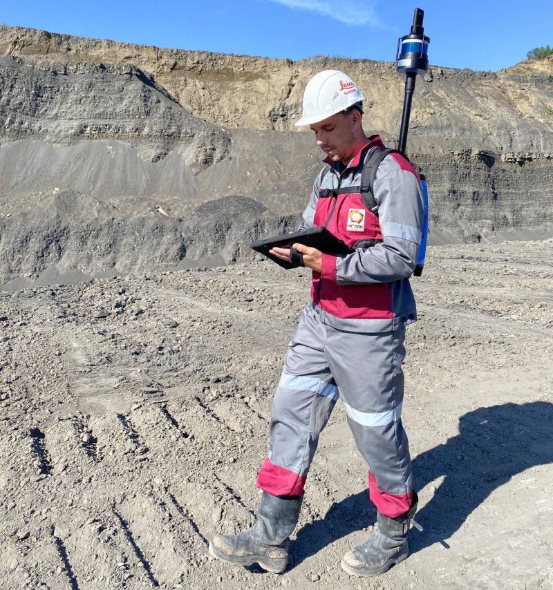
At the Taldinsky coal mine JSC "UK" Kuzbassrazrezugol "(an enterprise of the raw materials complex of UMMC) implemented a laser scanner LIDAR. The new equipment allows you to create 3D models of terrain and objects with a high degree of detail.
A laser scanner is a compact computer with a built-in digital camera that can be carried like a backpack. The image received by the camera is transferred to the tablet screen, and the operator visually controls the orientation of the device, highlighting the required scanning area. Thus, in a short time, a "cloud" of points is created, which precisely determines the location of objects.
"Today, ground-based laser scanning is the fastest and safest method of obtaining accurate and complete spatial information about an object," says the chief specialist of the service Natalya Perepilishchenko, chief mine surveyor of JSC MC Kuzbassrazrezugol. - The scanner can be put on or attached to the vehicle. In both cases, surveying can be carried out safely at a remote distance from the operating equipment and the sides of the mine, which allows scanning moving elements without interrupting production. ”
The laser scanner is part of a large set of digital technologies that the coal company uses in its work to create virtual twins of their cuts. The main task of the new equipment is to maintain the relevance of the data of the three-dimensional model of the enterprise.
Let us remind you that this year Taldinsky, the first of the Company's sections, received the basis of the future digital enterprise - a three-dimensional geological model of the field. Now the creation of a three-dimensional geological model of the Bachat branch is underway, the Krasnobrodsky and Kedrovsky sections are next in turn.


